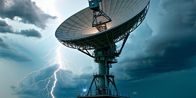
Understanding Radar Technology in Meteorology
Radar technology, fundamental in meteorology, utilizes radio waves to examine atmospheric conditions, providing critical data for weather forecasting. The radar emits signals that bounce off objects, allowing meteorologists to analyze precipitation type, intensity, and movement. By understanding how radar waves interact with different atmospheric elements, meteorologists can predict weather patterns accurately. The Doppler effect, a principle used in radar systems, helps assess storm velocity. As radar waves encounter moving raindrops, their frequency changes, revealing essential speed data. Through continuous advancements, radar technology now offers high-resolution imagery, enhancing weather predictions and warnings. Radar’s systematic approach to gathering atmospheric information makes it indispensable for understanding weather dynamics, enabling proactive responses to severe weather threats.
How Radar Collects Weather Data
Radar systems collect weather data by transmitting energy pulses and capturing returned signals from atmospheric particles. When radar pulses encounter raindrops, snowflakes, or hail, they scatter and reflect signals back to the radar. This process allows meteorologists to measure the precipitation’s location, intensity, and type. Modern radars, equipped with dual-polarization technology, differentiate various precipitation forms, enhancing the data’s accuracy. Additionally, radar’s ability to perform continuous scans ensures real-time monitoring of weather conditions. By comparing time intervals between the emitted and returned signals, radar systems determine the distance of precipitation, mapping out rainfall paths and intensities. This detailed data collection is crucial for issuing timely weather warnings and ensuring public safety during severe weather events.
Interpreting Radar Images for Forecasting
Interpreting radar images involves analyzing generated data into visual representations of weather systems. Meteorologists use these images to understand precipitation intensity, movement direction, and storm structure. Radar images, displayed as color-coded maps, indicate varying precipitation levels, with darker hues representing heavier rainfall. By examining these visuals, forecasters identify rotating systems, potential tornado formation, and severe storm conditions. This process requires a keen eye and experience to distinguish subtle patterns that may indicate dangerous developments. Radar’s capability to scrutinize altitude differences allows meteorologists to assess storm cloud formation height. Analyzing such information is vital for predicting thunderstorm behavior and issuing timely warnings. Consequently, radar interpretation aids in providing accurate weather forecasts, ensuring communities are well-prepared for approaching weather events.
Advancements in Radar Technology for Better Predictions
Advancements in radar technology have significantly improved weather predictions. New developments focus on enhancing data resolution and accuracy. Dual-polarization radars, for instance, provide detailed precipitation analysis by measuring radio wave orientation changes. This improves rainfall estimates, crucial for flood forecasting. Phased array radar technology, initially for military use, now boosts weather radar efficiency by scanning multiple atmospheric layers swiftly, detecting rapid weather changes. With these tools, meteorologists can better understand and predict severe weather events. These innovations allow meteorologists to identify weather phenomena earlier, improving forecast lead times and response strategies. Enhanced communication systems ensure timely data delivery, further enriching prediction capabilities. As research and development continue, radar technology advancements promise more precise, proactive weather forecasting.
Challenges and Limitations of Using Radar in Weather Prediction
Despite its advantages, radar technology faces challenges and limitations in weather prediction. One major issue is signal attenuation, where radar beams weaken when passing through heavy precipitation, causing inaccurate readings. Ground clutter, caused by radar signals reflecting off non-precipitation targets like buildings, can also distort data. Limited range is another challenge, as radar signals may fail to capture distant weather systems. Additionally, interpreting radar data requires expertise, with misinterpretations possibly leading to incorrect forecasts. While advancements mitigate some limitations, radars cannot provide comprehensive atmospheric data independently. Thus, their integration with other meteorological tools, like satellites and weather models, is crucial for holistic weather analysis. Understanding these limitations is vital for leveraging radar technology effectively in forecasting.