Understanding Weather Fronts
Weather fronts are crucial in meteorology, acting as boundaries between different air masses. They signify changes in temperature, humidity, and wind patterns. Cold fronts bring cooler air, often leading to storms, while warm fronts may cause gradual warming with light precipitation. Stationary fronts result when neither air mass advances, causing prolonged weather conditions. Occluded fronts occur when a cold front overtakes a warm front, often intensifying weather conditions. Recognizing these front types enables meteorologists to predict weather changes and prepare for potential impacts. Understanding the dynamics of these fronts helps in anticipating their influence on local and regional weather. By analyzing data from various meteorological tools, forecasters can provide timely warnings and insights, enhancing our ability to respond to and prepare for weather-related challenges effectively.
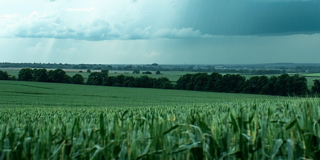
How Fronts Influence Weather Patterns
Fronts play a pivotal role in shaping the weather patterns we experience daily. When a cold front advances, it forces warmer air to rise, leading to the development of cumulus clouds and often resulting in thunderstorms. Conversely, warm fronts typically bring about steady, light rain as the warm air gradually overrides cooler air, ascending slowly and creating stratus clouds. Stationary fronts can lead to prolonged periods of precipitation when moist air ascends over cooler air. The interaction between different types of fronts can lead to a variety of weather phenomena, influencing not only local weather conditions but also broader climate patterns. By understanding how fronts interact with atmospheric elements, meteorologists can decipher changes in pressure and temperature, allowing for improved forecasting and enabling communities to better prepare for upcoming weather events.
Types of Precipitation and Their Causes
Precipitation is a crucial component of weather systems, classified into various types, each with unique causes. Rain forms when cloud droplets coalesce and fall when heavy enough. Snow occurs when temperatures are cold enough for atmospheric moisture to freeze. Sleet, or ice pellets, forms when raindrops freeze before hitting the ground, causing a mix of rain and ice. Hail develops during strong thunderstorms when updrafts repeatedly lift rain back into subfreezing levels, adding layers of ice. Freezing rain is a hazardous type where rain falls in liquid form but freezes upon impact with cold surfaces, creating a slick glaze. Each precipitation type is driven by atmospheric conditions like temperature and pressure, and understanding these helps meteorologists anticipate weather patterns and issue more accurate forecasts, crucial for preparation and safety.
The Relationship Between Fronts and Precipitation
Fronts serve as catalysts for various precipitation types due to their ability to force air masses to rise. Warm fronts bring about prolonged rain as warm air slowly glides over cooler air, forming layered stratus clouds. Cold fronts, on the other hand, cause severe weather when dense cold air pushes underneath lighter warm air, resulting in rapid ascent and the formation of storm-producing cumulus clouds. Stationary fronts, where two air masses meet without movement, can lead to extended periods of rainfall, particularly if the air ahead is moist. The interaction of contrasting air masses at these fronts sets the stage for different precipitation events, causing variability in weather patterns. Recognizing these interactions helps meteorologists predict precipitation types and their intensity, improving forecasting accuracy and preparation for potential weather-related disruptions.
Meteorological Tools for Studying Fronts
Meteorologists rely on an array of tools to monitor and study fronts, illuminating weather conditions and predicting changes. Weather satellites provide comprehensive views of fronts from space, capturing data on cloud formation and movement. Radar technology detects precipitation and storm systems associated with fronts, offering real-time information on their intensity and direction. Weather balloons, or radiosondes, measure temperature, humidity, and pressure at various altitudes, providing vertical profiles crucial for understanding atmospheric conditions. Surface weather stations record ground-level data essential for identifying fronts’ passage. Computer models synthesize these inputs, simulating front interactions and potential weather outcomes. Leveraging these tools aids meteorologists in analyzing and forecasting weather patterns reliably. The combination of various technologies enhances accuracy in predicting front-related weather changes, ensuring timely public advisories and improved preparedness.
Predicting Weather Changes Using Fronts
Fronts are key indicators in predicting weather changes, acting as significant dividing lines between different air masses. Cold fronts are often harbingers of swift weather changes, bringing about cooler temperatures and potential storms. Conversely, warm fronts usually indicate gradual warming and steady precipitation. Studying the speed and direction of front movement helps meteorologists anticipate shifts in weather patterns. Advanced computer models now incorporate front-related data, enhancing prediction accuracy. By analyzing pressure differences and temperature gradients, forecasters can infer the behavior of fronts and their impact on upcoming weather conditions. Understanding these dynamics is critical in predicting severe weather events, such as thunderstorms and heavy rainfall, enabling communities to take necessary precautions. The ability to accurately predict and respond to front-induced changes significantly improves public safety and reduces potential weather-related disruptions.