Understanding the Basics of Hydrological Data
Understanding hydrological data is essential in managing water resources and mitigating flood risks. This data encompasses various metrics such as rainfall, river discharge, and groundwater levels, providing a comprehensive picture of water movement through the hydrological cycle. Accurate data collection involves using weather stations, rain gauges, and satellite systems. This information is vital for creating models to predict floods and support decision-making in flood-prone areas. Additionally, historical hydrological data help identify patterns, allowing for better preparedness. As technology advances, the field of hydrology continues to evolve, offering more precise data collection methods. This foundational knowledge of hydrological data serves as the backbone for effective flood prediction and management, emphasizing the need for continuous research and development.
The Role of Hydrological Data in Flood Modeling
Hydrological data plays a crucial role in the development and refinement of flood models. These models rely on data such as precipitation levels, river flow, and soil moisture to simulate potential flood scenarios accurately. By incorporating current and historical data, predictive models can forecast flood events and assess their likely impacts. Advanced hydrological models integrate real-time data, enabling more responsive and dynamic flood management strategies. Furthermore, these models support decision-makers in implementing timely evacuation plans and infrastructure development to reduce flood risks. The integration of hydrological data into flood modeling underscores its importance in enhancing predictive capabilities and ensuring community resilience against floods. As climate change increases the frequency of extreme weather events, the reliance on accurate hydrological data becomes even more critical.
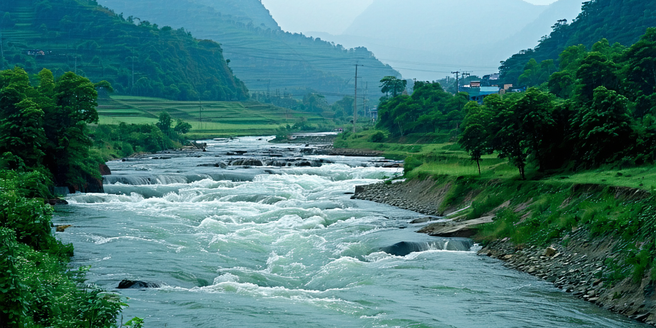
Types of Hydrological Data Used in Flood Prediction
Flood prediction depends on various types of hydrological data, each offering valuable insights into water dynamics. Common data types include precipitation data, which helps gauge incoming water volumes; river discharge data to monitor flow rates; and soil moisture content, affecting water infiltration and runoff. Groundwater levels also provide essential information on subsurface water conditions. These data types are collected through diverse methods such as weather stations, satellites, and on-ground sensors. By integrating these datasets, scientists can develop comprehensive models to predict flooding events accurately. Thus, understanding the range of hydrological data is crucial for improving prediction capabilities and minimizing the adverse effects of floods. With advanced technologies, the efficiency of data collection and analysis continues to improve, enhancing our ability to forecast and mitigate flood impacts.
Technological Advances in Collecting Hydrological Data
Technical innovations have significantly enhanced the collection of hydrological data, vital for effective water management and flood prediction. Remote sensing technologies, such as satellites, provide large-scale precipitation and surface water data, enhancing spatial data coverage. Ground-based sensors offer real-time information on river discharge, soil moisture, and groundwater levels. Additionally, advancements in data analytics enable more refined and accurate interpretation of hydrological data. The Internet of Things (IoT) plays a pivotal role, allowing interconnected devices to transmit data seamlessly, improving monitoring systems’ responsiveness. These technological advances facilitate more accurate flood forecasting and water resource management, highlighting the importance of continued investment in technology development. Combining traditional methods with innovative technologies optimizes data accuracy and ensures that communities are better prepared for flood risks.
Challenges in Using Hydrological Data for Accurate Forecasts
Utilizing hydrological data for accurate flood forecasting presents several challenges. Data quality and availability can vary significantly across regions, impacting the reliability of forecasts. Inconsistent data collection methods and outdated infrastructure may lead to data gaps. Additionally, integrating real-time data with historical records requires sophisticated processing methods. Climate change adds further complexity, altering weather patterns and introducing unprecedented scenarios that challenge existing models. Ensuring access to high-quality hydrological data is essential for developing precise predictive models. To overcome these challenges, investments in advanced technologies, standardized data collection practices, and international collaboration are imperative. Despite these obstacles, with continuous innovation and policy support, hydrological data can significantly enhance flood forecast accuracy, aiding in better preparedness and risk mitigation strategies.
Future Trends in Hydrological Data for Flood Risk Management
The future of hydrological data in flood risk management is poised for transformative advancements. Integration of machine learning and artificial intelligence in data analysis promises enhanced prediction models with improved accuracy and efficiency. Developing interconnected global monitoring systems will allow for the seamless sharing of data across borders, leading to more robust predictive capabilities. Additionally, advances in sensor technology and data analytics will provide more granular, real-time data. As urbanization and climate change increase flood risk, innovative data-driven approaches will become even more critical. Emphasizing interdisciplinary collaboration will also play a significant role in future developments. These trends suggest a shift towards more dynamic, adaptive flood risk management strategies, leveraging cutting-edge technology to protect communities and manage water resources effectively.