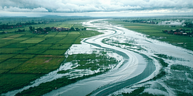
Understanding Flood-prone Zones
Flood-prone zones are regions susceptible to frequent flooding due to geographical and climatic factors. Understanding these areas involves analyzing flood plains, historical flood data, and hydrological patterns. This knowledge helps in predicting potential flood events and formulating mitigation strategies. Local topography, soil saturation levels, and weather conditions all contribute to the flood risk of an area. It is essential for authorities to continuously update flood risk maps to keep up with environmental changes and urbanization. Identifying these zones is crucial for developing appropriate urban planning strategies that minimize damage and ensure community safety. Urban planners need to collaborate with hydrologists and meteorologists to assess risks accurately and devise effective measures. Through data analysis and modeling, cities can enhance their preparedness and response, ultimately reducing impacts on infrastructure and livelihoods.
Key Principles of Urban Planning
Urban planning for flood-prone regions encompasses several critical principles aimed at minimizing flood impacts. Integrating land-use planning with flood risk management is essential. This involves restricting development in high-risk areas and promoting green spaces that can absorb excess water. Additionally, urban planners should focus on creating robust drainage systems that efficiently channel water away from vulnerable zones. Incorporating flood-resilient infrastructure and adaptive architectural designs can greatly enhance urban resilience. Planners must also consider the socioeconomic factors that influence vulnerability and ensure that plans are inclusive. Encouraging community participation in the planning process fosters a sense of collective responsibility and empowers residents to contribute to flood preparedness initiatives. These principles collectively aim to build cities that can withstand and recover from flooding events.
Infrastructure Design for Resilience
Designing resilient infrastructure in flood-prone areas is essential for minimizing the impacts of flooding. This involves using materials and construction techniques that withstand water exposure. Elevating buildings above expected flood levels and incorporating flood barriers can prevent damage to essential structures. Road and bridge designs should consider flood patterns and incorporate features like raised embankments to ensure accessibility during floods. Incorporating nature-based solutions such as wetlands and permeable pavements can enhance water absorption and reduce surface runoff. Resilience in infrastructure also requires regular maintenance, ensuring that systems like drainage and levees function optimally. By prioritizing resilient infrastructure design, urban planners can create safe, functional environments that protect both people and property from the adverse effects of flooding.
Community Engagement and Education
Community engagement and education play a pivotal role in urban planning for flood-prone zones. Effective communication and active involvement help build community resilience. Educating residents about flood risks and preparedness actions encourages proactive behavior. Workshops and training sessions can provide valuable information on emergency responses and resource management. Creating community-based flood monitoring and alert systems empowers locals to respond swiftly to potential threats. Collaborative planning initiatives that include community feedback ensure that the needs and concerns of residents are addressed. Social media platforms and local gatherings can serve as effective channels for disseminating information and fostering dialogue. By fostering a well-informed and engaged community, cities can enhance their capability to withstand and recover from flood events.
Case Studies: Success Stories in Adaptation
Examining case studies of successful flood adaptation can provide invaluable insights for urban planners. For instance, the city of Rotterdam has implemented innovative water management strategies, such as the construction of water plazas and green roofs, to mitigate flood risks. These initiatives reduce surface runoff and increase water storage capacity. Similarly, Singapore has integrated its Drainage Master Plan with urban development to effectively manage rainwater. In New Orleans, post-Hurricane Katrina efforts focused on improving levee systems and investing in community resilience programs. These cases illustrate how strategic planning and investment in infrastructure can transform vulnerability into resilience. By learning from these examples, cities worldwide can adopt and adapt similar strategies to enhance their flood preparedness and protect residents from the impacts of climate change.