Introduction to Remote Sensing Technologies
Remote sensing technologies revolutionize how we observe and understand Earth’s atmospheric phenomena. By using sensors on satellites or ground-based platforms, we can acquire data about the planet’s surface and atmosphere without physical contact. This technology has applications across various fields, including weather studies, where it provides critical data for monitoring climatic conditions. Remote sensing allows for the collection of large-scale data over extended periods, aiding in the analysis of weather patterns and trends. Instruments equipped with advanced imaging capabilities, such as multi-spectral and hyper-spectral cameras, can detect changes in land use, vegetation health, and water bodies, all of which influence weather systems. Moreover, the integration of remote sensing data with other meteorological datasets enhances the accuracy of weather forecasts, providing essential information for researchers and decision-makers in managing climate-related challenges.
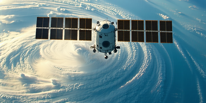
The Role of Satellites in Weather Forecasting
Satellites play a pivotal role in modern weather forecasting by providing a comprehensive view of Earth’s atmosphere. Equipped with various sensors, satellites gather data on temperature, humidity, wind patterns, and cloud formations at different atmospheric levels. This wealth of information enables meteorologists to accurately predict weather conditions and track severe weather events like hurricanes and cyclones. The global reach of satellites ensures coverage of remote and inaccessible regions, where ground-based observations may be sparse. By constantly monitoring the Earth’s surface, satellites also contribute to real-time weather data dissemination, allowing for timely warnings and responses to adverse weather conditions. As technology advances, the precision and reliability of satellite data continue to improve, making them an indispensable tool for understanding and forecasting weather phenomena and contributing to global climate studies.
Advantages of Remote Sensing in Meteorology
Remote sensing technology offers numerous advantages for meteorology, significantly enhancing our ability to observe and analyze atmospheric processes. One of its primary benefits is the ability to collect vast amounts of data over large geographic areas in real-time, which is crucial for timely and accurate weather predictions. Unlike traditional observation methods, remote sensing provides consistent global coverage, including difficult-to-access regions, making it indispensable for comprehensive climate monitoring. The non-invasive nature of remote sensing allows for repeated measurements, enabling the study of dynamic weather patterns and trends over time. Furthermore, the integration of data from various sensors and platforms allows meteorologists to achieve a multi-dimensional understanding of weather systems, leading to more accurate forecasting models. This, in turn, supports better decision-making for weather-related challenges, such as resource management, disaster response, and climate change adaptation.
Challenges Faced in Remote Weather Observation
Despite its many advantages, remote weather observation faces several challenges that impact its effectiveness. One major challenge is the calibration and validation of remote sensing instruments, which are essential for ensuring data accuracy. Variability in sensor performance due to environmental influences, such as temperature fluctuations, can lead to measurement errors. Furthermore, the interpretation of remote sensing data requires complex algorithms and models, necessitating sophisticated computational resources and expertise. Cloud cover is another significant obstacle, as it can obstruct sensors’ views of the Earth’s surface, complicating data collection and analysis. Additionally, the integration of data from multiple sources can be technically challenging due to differences in resolution, coverage, and data formats. Addressing these challenges requires continual technological advancements and collaboration between researchers, governments, and industry to ensure the reliable use of remote sensing for meteorological applications.
Applications of Remote Sensing in Climate Research
Remote sensing plays a crucial role in climate research by providing comprehensive data that aids in understanding long-term climate patterns and trends. It enables the monitoring of land surface changes, ocean temperatures, sea level rise, and atmospheric gas concentrations, all of which are critical parameters in climate studies. By using satellite observations, scientists can assess the effects of climate change on various ecosystems and the frequency and intensity of extreme weather events. Remote sensing data also facilitate the validation and enhancement of climate models, leading to more accurate predictions of future climate scenarios. Additionally, the continuous and consistent nature of remote sensing observations allows for the establishment of long-term climate data records. These records are invaluable for researchers as they seek to understand climate variability and assist policymakers in formulating strategies to mitigate and adapt to climate change impacts.
Future Trends in Remote Sensing for Weather Analysis
The future of remote sensing in weather analysis is set to be shaped by technological innovations and increased demand for precise and timely data. Advancements such as miniaturized sensors and CubeSats, small satellites that offer cost-effective data collection, are expected to revolutionize Earth observation. Additionally, the integration of artificial intelligence and machine learning algorithms will enable more sophisticated analysis and interpretation of vast datasets, leading to improved weather predictions. There is also a growing emphasis on developing hyper-spectral imaging technology, which can provide detailed information about atmospheric components and land cover. Furthermore, international collaboration among space agencies and research organizations will likely enhance data sharing and interoperability, expanding the global remote sensing network. These trends suggest that remote sensing will continue to be a pivotal tool in understanding and addressing the challenges posed by weather and climate change.