Introduction to Remote Sensing in Meteorology
Remote sensing has revolutionized how meteorologists study the atmosphere, enabling the collection of critical data from weather systems, oceans, and land. This technique involves the acquisition of information about an object or phenomenon without making physical contact, using tools like satellites and radars. In meteorology, remote sensing is invaluable for observing atmospheric conditions, allowing for more accurate weather predictions. This information is essential in understanding weather patterns and climate change, aiding in the development of models that improve our comprehension of natural phenomena. The vast amounts of data collected help meteorologists track storms, measure rainfall, and observe temperature variations globally. As the demand for more precise weather forecasting grows, the role of remote sensing will only continue to expand, providing more comprehensive insights into the complexities of Earth’s atmosphere.
The Evolution of Remote Sensing Technologies
Over the decades, remote sensing technologies have advanced dramatically, reshaping meteorology. Initially, data collection was limited to manual observations and basic instruments. With the launch of the first weather satellites in the 1960s, the field witnessed a seismic shift, offering unprecedented views of Earth’s weather systems. Technological evolution has since introduced sophisticated satellites, advanced radar systems, and cutting-edge sensors that provide high-resolution, real-time data. Developments in computing power and data processing have further enhanced our ability to interpret and utilize this data effectively. These advancements have transformed weather forecasting from an art to a science, greatly increasing its accuracy and reliability. As technology continues to advance, we can anticipate even more refined remote sensing tools, promising further enhancements in the predictive capabilities of meteorology.
Types of Remote Sensing Devices Used in Weather Forecasting
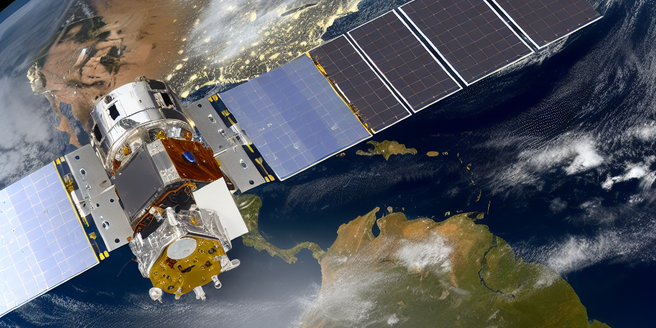
Weather forecasting today relies heavily on a range of remote sensing devices, each serving a unique purpose in data collection. Satellites, positioned in orbit around Earth, gather critical information on cloud patterns, surface temperatures, and atmospheric gases. These include geostationary satellites for continuous observation and polar-orbiting satellites for comprehensive scans of the entire planet. Radar systems are crucial for tracking precipitation, measuring its intensity, and predicting storm paths. Doppler radars, in particular, offer insights into wind speeds and detect severe weather conditions like tornadoes. Ground-based sensors and radiosondes provide vertical profiles of temperature, humidity, and wind. Combined, these technologies enable meteorologists to create detailed models of the atmosphere, significantly improving weather forecasts and early warning systems for extreme weather events.
Data Collection and Analysis in Meteorology
Data collection and analysis form the backbone of meteorology, leveraging remote sensing technologies to gather accurate and timely information. With advancements in satellite imagery and radar technology, meteorologists can observe and analyze vast quantities of data from multiple sources. Satellite data provide global coverage, capturing vital information on weather systems, sea surface temperatures, and atmospheric gases. Meanwhile, radar installations deliver high-resolution data on precipitation, humidity, and wind patterns. The integration of these diverse data sets is facilitated by advanced computing systems, enabling meteorologists to perform complex analyses and simulations. This process yields precise forecasts, assisting in decision-making for various sectors, such as agriculture, aviation, and disaster management. As data processing capabilities improve, meteorologists can exploit even more substantial data for comprehensive weather analysis.
Challenges and Limitations of Remote Sensing
Despite its importance in meteorology, remote sensing faces several challenges and limitations. One primary issue is data accuracy, as atmospheric interference and instrument calibration can impact measurement precision. Additionally, cloud cover can obstruct satellite views, leading to incomplete data sets. Satellites are also limited by their spatial and temporal resolution, which can affect the detail and frequency of data collected. Ground-based radar systems, while effective for localized weather forecasts, have limited range and can struggle in complex terrain. Managing and processing the vast amounts of data produced by remote sensing technologies requires significant computational resources and expertise. Moreover, integrating data from multiple sources into coherent predictions is complex and can introduce uncertainties. Addressing these challenges requires ongoing research, technological advancements, and international collaboration.
Future Prospects of Remote Sensing in Weather Prediction
The future of remote sensing in weather prediction is promising, driven by technological advancements and increasing demand for accurate forecasts. Emerging technologies such as hyperspectral imaging, next-generation satellites, and drones are set to revolutionize atmospheric data collection. These innovations promise higher resolution, enhanced accuracy, and broader spectral coverage, allowing for more detailed observations of weather phenomena. Machine learning and AI are being harnessed to analyze complex datasets, uncovering new insights and improving predictive models. Combined with superior data processing capabilities, these developments will enable more precise and timely forecasts, aiding in early warning systems for natural disasters. As global climate change presents new challenges, the role of remote sensing will become even more critical in understanding and responding to dynamic weather patterns, protecting lives and property.