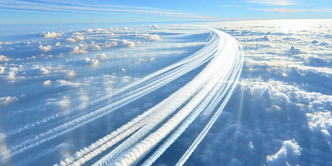
Understanding Jet Streams: An Overview
Jet streams are fast-flowing air currents high in the atmosphere, typically found at altitudes from 6 to 9 miles above sea level. They play a critical role in influencing weather patterns and are primarily driven by the temperature difference between the equator and the poles. The strength and position of jet streams can vary daily, affecting local weather conditions significantly. For example, when a jet stream sits north of a location, it can bring warmer weather, while its southerly position can lead to cooler temperatures. Comprehending the dynamics of jet streams is crucial for meteorologists as they shape the movement of weather systems, impacting everything from high-pressure systems to cyclones. Understanding these global wind patterns enhances our ability to predict weather changes accurately, though their quick shifts and complexities pose ongoing challenges.
The Role of Jet Streams in Weather Patterns
Jet streams play a pivotal role in shaping weather patterns across the globe. They are narrow bands of strong winds in the upper levels of the atmosphere, which can influence the movement of weather fronts. These high-altitude currents can affect the development and direction of storm systems. When a jet stream dips south, it can usher cold air into warmer regions, leading to sudden temperature drops and extreme weather conditions. Conversely, when it flows north, it can bring warm air into cooler areas. The position and strength of jet streams can dictate the formation of high and low-pressure systems, thereby affecting rainfall distribution and seasonal weather patterns. By directing storms and influencing their intensity, jet streams are vital in understanding broader climatic events and their immediate impacts on the local weather.
How Jet Streams Influence Forecasting Techniques
Jet streams are a key element in modern weather forecasting techniques. Their position and trajectory can dramatically influence the accuracy of weather predictions. Meteorologists observe jet streams to anticipate changes in weather conditions and to determine the potential development of storm systems. Understanding the speed and direction of these high-altitude winds allows forecasters to model the movement of weather patterns with greater precision. For instance, jet streams can hasten or delay the arrival of weather fronts, impacting the timing of rain, snow, and temperature changes. By integrating jet stream data into computer models, forecasters improve predictions of extreme weather events, helping to issue timely warnings. Despite advancements, predicting jet stream behavior remains complex due to their rapid shifts, which can challenge even the most sophisticated forecasting models.
Challenges in Predicting Jet Stream Movements
Predicting jet stream movements presents several challenges for meteorologists. One primary difficulty is their highly dynamic nature; jet streams can shift dramatically in both speed and direction, influenced by various atmospheric factors. Their interaction with large-scale weather patterns, like El Niño and La Niña, adds another layer of complexity. Jet streams also exhibit seasonal variability, complicating predictions further. These factors make it difficult to predict their precise impact on local weather conditions over the long term. Additionally, gaps in atmospheric data and limitations in current forecasting models contribute to the unpredictability of jet streams. Overcoming these challenges requires ongoing research and advancements in observational techniques. Improved satellite technology and enhanced computational models are vital for better understanding these intricate air currents and enhancing the accuracy of long-term weather forecasts.
Advancements in Technology Improving Accuracy
Recent advancements in technology have significantly improved the accuracy of weather forecasting, particularly concerning jet streams. High-resolution satellites provide detailed data on atmospheric conditions, allowing meteorologists to monitor jet streams with greater precision. Doppler radar and improved computer models enable forecasters to analyze the speed and trajectory of jet streams more accurately. These tools help predict shifts in weather patterns and anticipate the development of severe weather events, such as storms or cold fronts. Machine learning algorithms are increasingly used to process vast amounts of data, highlighting patterns that human analysts might miss. Such technological advancements are pivotal in enhancing our understanding of jet streams, reducing the margin of error in weather predictions. As technology continues to evolve, it promises even greater improvements in predicting the complex behavior of these vital atmospheric currents.