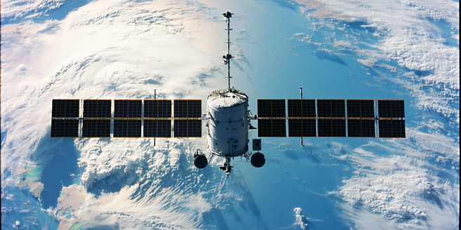
Understanding Satellite Technology in Weather Forecasting
Satellites play a crucial role in modern weather forecasting by providing comprehensive and real-time data that was previously unattainable. By orbiting the Earth, satellites gather critical information such as atmospheric temperature, humidity, and cloud cover. This data is crucial for predicting weather patterns and anticipating natural disasters. Unlike traditional weather stations that only offer localized data, satellites offer a global perspective, enabling meteorologists to understand weather systems on a much larger scale. The imagery and data collected can be used to track storm development, monitor climate change, and even assist in disaster management. As technology advances, satellites are becoming increasingly sophisticated, offering higher resolution imagery and quicker data transmission, which significantly enhances the accuracy and reliability of weather forecasts.
The Importance of Early Weather Warnings
Early weather warnings are vital for minimizing the impact of severe weather events on life and property. By providing timely alerts, these warnings help communities prepare and adapt in advance, potentially saving countless lives. Satellites contribute significantly to this process by swiftly delivering data that help identify potentially hazardous weather conditions. With early warnings, people can evacuate impacted areas, safeguard their belongings, and take necessary precautions. Furthermore, satellite data often provides the only indicators for impending calamities in remote and under-resourced regions. Advances in satellite technology have dramatically improved forecasting accuracy, enabling meteorologists to issue warnings earlier and more consistently than ever before. As we face increasing weather volatility due to climate change, the role of early warnings in protecting vulnerable populations cannot be overstated.
How Satellites Revolutionize Data Collection
Satellites have transformed data collection by providing detailed and extensive observations that cover vast areas of the Earth’s surface. Unlike ground-based sensors, which are limited by geography and accessibility, satellites offer the ability to collect data over oceans, mountains, and other remote regions. This revolutionizes weather data, allowing continuous, long-term monitoring of global climate patterns. With the aid of various sensors, satellites can measure temperature, humidity, and even the speed and direction of winds. This wealth of data is invaluable to scientists and meteorologists who synthesize this information to improve weather models and predictions. As technology develops, satellite data collection is becoming more refined, offering unprecedented resolution and accuracy, which translates into better-informed decision-making processes across numerous sectors.
Challenges in Interpreting Satellite Weather Data
Interpreting satellite weather data presents a set of unique challenges despite its indispensable contributions to modern meteorology. One of the main difficulties lies in the complex nature of the data, which often requires robust algorithms and advanced processing to accurately derive meaningful information. Additionally, satellite data can be affected by factors such as cloud cover and atmospheric conditions, potentially leading to inaccuracies in readings. Calibration and validation of satellite instruments also play a crucial role in ensuring reliable data interpretation. Furthermore, the sheer volume of data collected necessitates sophisticated data management systems and skilled personnel to handle and analyze it. Researchers and meteorologists work continuously to address these challenges, employing machine learning and artificial intelligence to enhance data processing capabilities and improve the precision of weather forecasts derived from satellite data.
Future Innovations in Satellite Weather Alerts
Future innovations in satellite weather alerts promise to further enhance the accuracy and timeliness of forecasts. With the rapid advancement of technology, new satellite designs equipped with state-of-the-art sensors are expected to provide more precise and comprehensive weather data. Such innovations may include increased temporal resolution to capture evolving weather phenomena in real-time, higher spatial resolution for detailed regional analysis, and advanced AI algorithms for faster data processing. The next generation of satellites will potentially employ constellations of small satellites working together to cover the globe more thoroughly and reduce data latency. These advancements will not only benefit weather forecasting but also aid in climate research and environmental monitoring. As global weather patterns continue to change, these upcoming satellite technologies will play a critical role in bolstering the resilience of societies against extreme weather events.