Understanding Mountain Weather Patterns
Mountain weather is notoriously unpredictable due to rapidly changing conditions influenced by altitude, terrain, and wind patterns. Understanding these factors is crucial for accurate forecasting. Mountain ranges can create their own microclimates, where weather conditions can change from sunny to stormy within minutes. Meteorologists study these patterns to improve predictions, focusing on how air masses interact with the landscape. They analyze temperature gradients, pressure changes, and moisture content to anticipate weather shifts. Accurate forecasts can help in planning outdoor activities, preventing accidents, and preparing for sudden weather events. Investing in research to decode these patterns is essential, especially as climate change alters established weather notions. Continued advancements in technology will ultimately enhance our understanding and forecasting abilities.
The Role of Radar in Weather Forecasting
Radar technology has revolutionized weather forecasting by providing detailed real-time data on precipitation, wind speed, and cloud formations. In mountainous areas, radar is particularly useful as it penetrates areas otherwise difficult to observe. It helps meteorologists track storm developments, identify potential weather threats, and issue warnings promptly. Doppler radar, for instance, detects motion within storm systems, allowing experts to monitor wind shifts and gauge storm intensity. This level of detail significantly enhances predictive accuracy, which is vital for regions prone to extreme conditions. Additionally, radar data helps in verifying and refining weather models. The integration of radar technology into daily weather forecasting aids in reducing uncertainty and improving response strategies during severe weather events, ultimately safeguarding communities and minimizing economic losses.
Advancements in Radar Technology
Recent advancements in radar technology have significantly impacted the field of meteorology, especially in the context of mountainous weather forecasting. Dual-polarization radar, for example, provides meteorologists with more precise data by transmitting both horizontal and vertical pulses. This innovation enhances the ability to distinguish between different types of precipitation, such as rain, snow, and sleet, improving forecasts’ accuracy. Furthermore, phased-array radar offers faster data collection, enabling real-time analysis crucial for severe weather events. Portable radar units also allow for deployment in remote areas, ensuring comprehensive coverage in challenging terrains. These technologies, when combined with satellite data, create a powerful network for meteorologists, enabling them to track weather systems with unprecedented detail and accuracy. As radar technology continues to evolve, further improvements in prediction models are anticipated, leading to safer and more informed communities.
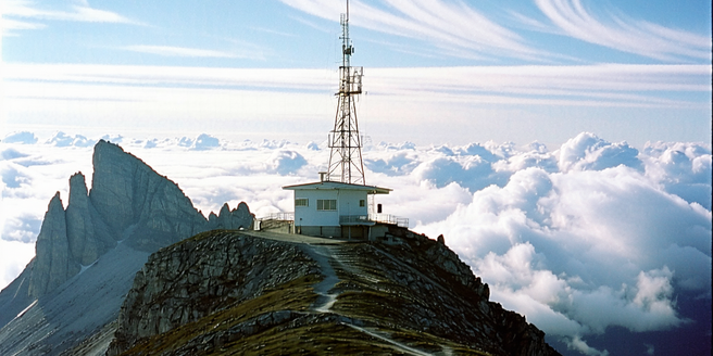
Challenges in Predicting Mountain Weather
Predicting mountain weather poses unique challenges due to the complex topography and variability inherent in these regions. The presence of valleys, peaks, and vast elevation changes creates microclimates that standard forecasting models may not fully capture. Additionally, the rapidly changing weather conditions often require high-resolution data, which is not always readily available. Radar technology, while beneficial, can face limitations due to beam blockage by mountainous terrain, reducing the accuracy of predictions. Furthermore, limited infrastructure in some remote regions impedes data collection efforts. Addressing these challenges requires a multifaceted approach, combining advancements in technology with traditional meteorological methods to improve data accuracy and accessibility. Collaborative efforts across national and international meteorological communities are essential to overcoming these obstacles, ensuring better preparation and response to mountain weather phenomena.
Benefits of Enhanced Weather Predictions
Enhanced weather predictions in mountainous regions offer significant safety and economic benefits. Accurate forecasts allow hikers, climbers, and tourists to plan their activities safely, reducing the risk of weather-related accidents. For local communities, improved predictions mean better preparation for adverse weather conditions, thus minimizing losses and disruption. Agriculture also benefits, as farmers can make informed decisions regarding planting and harvesting schedules, ultimately leading to increased productivity and reduced crop damage. Enhanced weather predictions additionally aid in wildlife management and conservation efforts by anticipating changes in the ecosystem caused by weather fluctuations. Importantly, the tourism industry benefits from precise forecasts, attracting more visitors due to increased safety and reliability. Continuous improvements in forecasting provide valuable insights, fostering resilience and adaptability in the face of climatic changes.
Future Trends in Mountain Weather Forecasting
The future of mountain weather forecasting is poised to be shaped by technological innovations and increased data integration. The development of AI and machine learning algorithms promises to enhance predictive models by rapidly analyzing large datasets for patterns. These technologies can improve the precision of forecasts by learning from past weather events and adapting to new data. Satellite technology will also play a more prominent role, offering high-resolution imagery and comprehensive atmospheric data. Additionally, collaborations between international meteorological organizations are expected to increase, pooling resources and knowledge for global benefit. The expansion of remote sensing technologies will provide broader coverage and better data for inaccessible regions. As these advancements continue, mountain weather forecasting is likely to become more accurate, reliable, and actionable, enabling communities to better prepare for and respond to weather-related challenges.