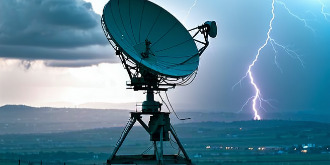
Understanding Radar Technology in Emergencies
Radar technology plays a crucial role in emergency preparedness by providing real-time data about weather conditions, geographical formations, and potential obstacles. Its ability to accurately detect approaching storms or natural disasters, such as hurricanes or tornadoes, allows for timely alerts and efficient evacuations. In addition to weather predictions, radar is used in search and rescue operations to locate individuals in distress. In a crisis, radar systems can differentiate between various types of precipitation, helping to predict flood conditions and assess the possible impact. The data collected through radar contributes to the creation of precise and detailed emergency response plans, ensuring that resources and personnel are deployed effectively. By understanding how radar works, emergency services can improve their response times and accuracy when dealing with unpredictable events.
Key Benefits of Radar in Crisis Situations
Radar provides several benefits in crisis situations, foremost among them is its ability to operate in all weather conditions, ensuring consistency of data even when visual observation is impossible, such as in fog or heavy rain. Radar systems also offer a wide range of coverage and an extensive detection range, facilitating early identification of threats. They are indispensable for air traffic management in emergencies, ensuring that aircraft avoid hazardous weather and reroute efficiently. Additionally, radar strengthens coordination among response teams by providing a unified operating picture. This enhances decision-making processes, optimizes resource allocation, and minimizes disaster impacts, safeguarding both lives and property. As a technology that bridges gaps in visibility and information, radar is an invaluable tool for enhancing resilience against catastrophic events.
Integrating Radar Systems in Emergency Plans
To fully leverage radar technology, it is critical to integrate it within existing emergency plans. This involves establishing protocols that link radar data with communication networks used by emergency responders. Collaboration between meteorological services and response teams ensures that radar insights translate into actionable strategies. Training programs need to be developed to familiarize emergency personnel with the interpretation and use of radar data. Integrating radar systems involves regular updating and maintenance of hardware to remain effective. Factoring radar capabilities into emergency simulations enhances preparedness and highlights potential areas for improvement. By embedding radar into emergency response frameworks, communities can anticipate threats more effectively, reducing the time to react and improving overall resilience against natural and man-made disasters.
Case Studies: Radar in Action During Disasters
Historical case studies highlight the utility of radar in disaster management. During Hurricane Katrina, radar technology was pivotal in tracking the storm’s path, offering vital data that influenced evacuation orders and resource deployment. Similarly, in the 2011 Joplin tornado event, advanced radar helped identify the system’s strength and trajectory, aiding emergency management in strategic planning and timely warnings for residents. In these instances, radar proved essential for minimizing fatalities and managing the chaotic aftermath of natural disasters. Furthermore, the use of radar in monitoring volcanic eruptions has been beneficial, as seen with Iceland’s Eyjafjallajökull, where radar tracked ash clouds that threatened air travel. These case studies illustrate how radar not only facilitates immediate responses to crises but also demonstrates its role in saving lives through accurate situational awareness.
Future Developments in Radar for Emergency Prep
Advancements in radar technology promise to enhance emergency preparedness capabilities. Future radars may incorporate AI algorithms to predict the development of dangerous weather patterns with greater accuracy. Miniaturization and cost reductions will likely lead to more widespread radar deployment, even at community levels, enhancing localized threat detection. Innovations such as 3D radar imaging and phased-array radar systems could offer detailed environmental observations in real-time. As radar technology evolves, it will integrate more seamlessly with smart cities and IoT devices, providing holistic and instantaneous data sharing across platforms. Wireless radar communications might also emerge, expanding radar applications to remote or unmanned environments. These potential developments signify a future where emergencies can be managed with unprecedented precision and efficiency, ultimately leading to safer communities.